

The Wetland Assessment Program (WAP) at UMass Amherst is an ongoing research program, the main goal of which is to study wetland ecosystems and to develop better tools for monitoring and conservation of these areas. (http://www.umasscaps.org/applications/wetlands-assessment.html) Headed by Dr. Scott Jackson and Dr. Kevin McGarigal for the past decade, WAP is part of the larger Conservation Assessment and Prioritization System (CAPS). The main strategy of the program is to find and measure relationships between Landsat data – which includes land use data, elevation, slope, etc. – and both Indices of Biological Integrity (IBIs) and Indices of Ecological Integrity (IEI’s). The specific sampling and observation methods vary depending on the type of wetland system under consideration. The program has had significant success in finding meaningful and useful patterns for most wetland systems, however success with salt marsh studies has been elusive.
The team’s current thinking is that for salt marshes, too much emphasis in the research protocols has been place on species abundance. Because of the relatively low level of biodiversity in these systems it seems reasonable that attempts to measure variations in relative species abundance would be less sensitive to the health of the ecosystem. Instead, the team has recently started to look more critically at both overall plant health and detailed terrain morphology and flooding patterns.
The recent advent of affordable, reliable unmanned aerial systems (UASs) provides the team with an opportunity to survey hundreds of acres of salt marsh landscape at a time. Starting in the summer of 2017 our team has been conducting dozens of flights over coastal salt marsh regions, colleting images, and then using photogrammetry software to reconstruct color orthmosaics as well as digital elevation models (DEMs) and digital surface models (DSMs) of the landscape. This wealth of data allows us to look for signals in the morphology, color, and, in the near future, spectral reflectance of the terrain.
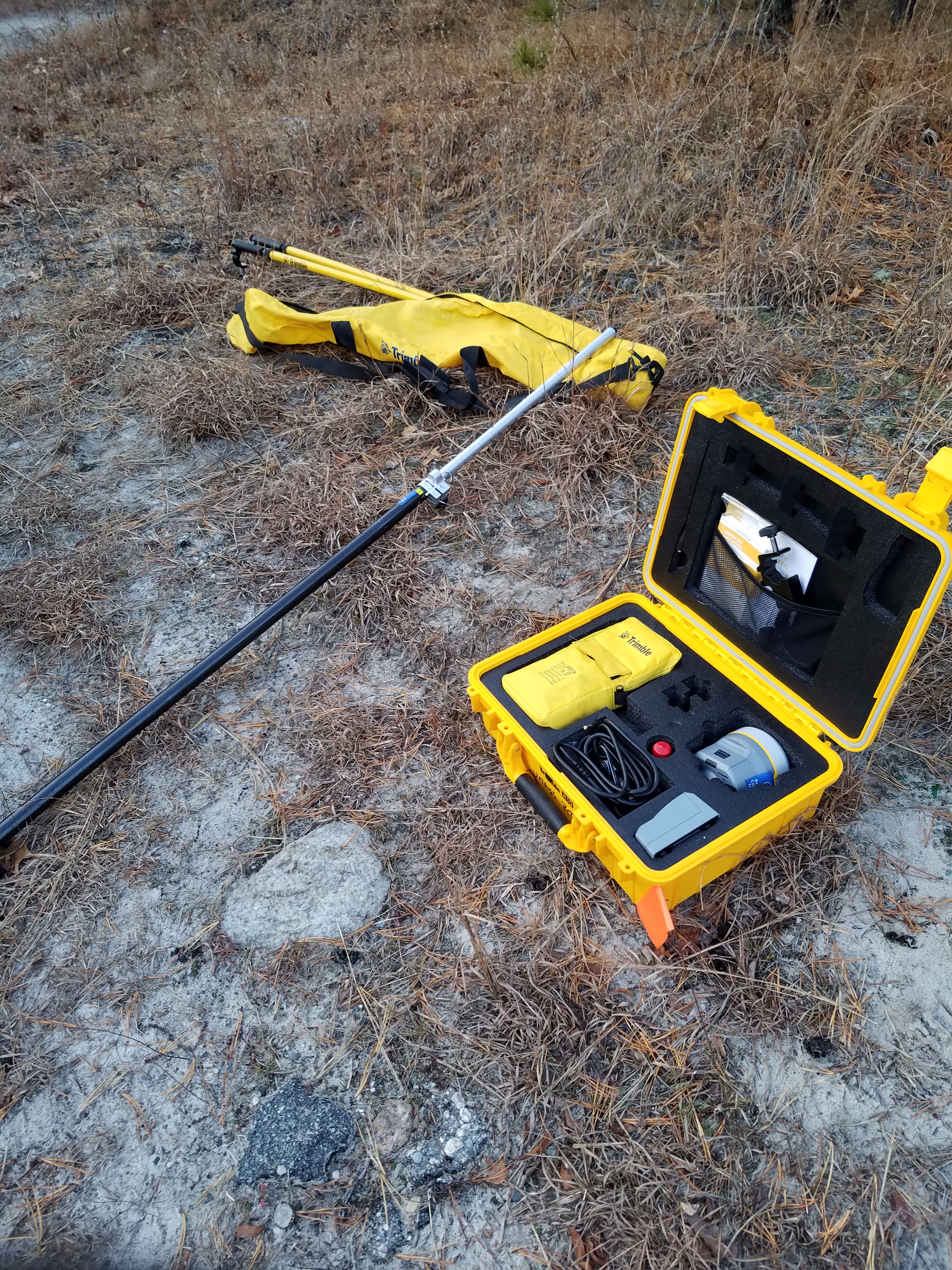
One of our greatest challenges, however, has been to ensure the position accuracy of our orthomosaics and the elevation values in our DEMs. In order to ensure a high level of accuracy our team employed the use of ground control points (GCPs) that we placed in the sites that we surveyed with the drone. The use of the Trimble R10 units allowed us to survey these locations to within 3 centimeters, and therefore constrain the orthomosaic and DEM reconstruction algorithms more tightly and produce products of much higher accuracy than we would have otherwise been able to achieve. Without the use of this equipment our project objectives would have been many times more difficult if not impossible to achieve. Ultimately being able to measure the locations of the GCPs to such a high degree of accuracy is necessary to have our orthomaic time-series data align correctly and to have reliable measures of terrain morphology change. We are incredibly grateful to have the opportunity to use this technology to improve our survey methods.
Gallery:


More Information:
Trimble Tech Used:
- R10 GNSS receivers
People Involved:
- Ryan Wicks