Using Trimble R10 to Validate Photogrammetry Products

by Ryan Wicks | January 2023

Introduction

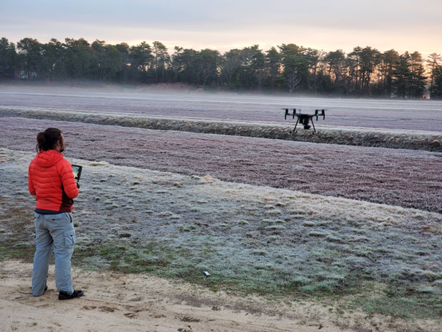
RTK GNSS receivers are one of many tools that are leveraged for conducting survey work, and with the addition of unoccupied aircraft systems (UASs) to supplement GNSS receivers, theodolites, and the like, new survey techniques are being used and further refined to collect data about the landscape and physical features of interest. A common workflow is to have several ground control point (GCP) markers distributed throughout an area of interest that is to be surveyed, to survey those few GCP locations with a RTK GNSS receiver or some other ground survey tool, and then fly a drone to collect aerial imagery of the entirety of the area of interest; so long as a significant portion of the images that the drone took have the GCP markers visible in the images, then the surveyed GCPs can be used to constrain a photogrammetry reconstruction from the drone images to have a similar level of accuracy throughout the survey area. I’ve touched on this technique in a few of my other articles. This can be an effective technique for attaining a high spatial accuracy over a large area at a resolution that wouldn’t be possible without instrumentation like LiDAR. While this workflow is sufficient in many cases, there is an additional role in this process that RTK GNSS receivers can play: assessing the accuracy of final photogrammetry products.

Continue reading “Using Trimble R10 to Validate Photogrammetry Products”

Mapping the UMass Amherst Campus Using UAS Aerial Imagery 2023

By Ryan Wicks | 25 Jun 2023

Introduction

If you’ve visited the UMass Amherst campus occasionally in the last 10 years you may have noticed dozens of new construction projects of various sorts popping up all over the campus; new academic buildings, solar panel parking canopies (https://www.umass.edu/sustainability/climate-change-energy/solar-energy/2017-solar-projects), and geothermal well drilling, just to name a few. To coordinate these efforts effectively, up-to-date information – specifically GIS data – is quite helpful. Not only does the UMass Amherst Physical Plant leverage drones and Trimble R10 RTK to regularly survey progress on construction projects, but they also host a campus-wide GIS working group whose focus is to promote and leverage the power of GIS data, tools, and ancillary equipment to provide highly detailed, highly accurate, current information to any departments and decision makers in the UMass network.

Continue reading “Mapping the UMass Amherst Campus Using UAS Aerial Imagery 2023”

UAS Agriculture Applications: Selected Agricultural Research Projects from the last 6 Years

by Ryan Wicks | Summer 2023

Introduction

For decades aircraft and spacecraft technologies have been leveraged in agriculture. For aircraft applications, aerial crop dusting might come to mind, and I include spacecraft technologies for at least two roles that they play: for one they are used for remote sensing in a variety of applications, some of which collect information on environmental conditions that impact agriculture as well as collecting information on soil or vegetation health on farmland; secondly they are used indirectly to assist in navigation of other survey tools and automated fertilizer or pesticide application systems. With the proliferation of unpiloted aircraft systems (UASs), or “drones”, these technologies have been added to tools that can be leveraged in agriculture. While they have been adopted at different rates and in different ways for agriculture in different parts of the world in the past couple of decades, there seems to be a definitive niche for their use in some way or another in agriculture, though that niche varies depending on the geological region and what kind of agriculture they are being used to support.

Agricultural applications of drones are not my own focus area, but for some of my colleagues it is the primary focus of how they think about leveraging drones, and certainly I have not been entirely absent from using UAS and survey tools in support of agricultural applications. While I could talk in detail about any number of theses agriculture-related projects, in this article I want to give a brief overview of how different teams at UMass have leveraged more advanced survey tools like UAS and RTK GNSS in support of their work.

Continue reading “UAS Agriculture Applications: Selected Agricultural Research Projects from the last 6 Years”

BCT’s Design / Build Models – 2022 Edition

The models shown above are from Project 2 in BCT 420 “Designing in 3D CAD & BIM” and ECO 620 “Studies in BIM”, a project-based course that teaches Trimble SketchUp, Realworks and Autodesk Revit. In this project students are being asked to digitally design and then fabricate a “useful object” using any of these methods: wood model building, paper model building, casting, 3D printing, CNC cutting. Continue reading “BCT’s Design / Build Models – 2022 Edition”

Surveying a Retaining Wall


UMass BCT Graduate Student Brett Barnard can be seen here operating the Trimble TX8 3D Scanner with Senior Andrew Smith and Sophomore Leo Minniti to survey and analyze a retaining wall on the Amherst campus. They plan to scan the entire wall in both Fall and Spring to obtain multiple 3D point clouds of the area for surveying and mapping purposes. Continue reading “Surveying a Retaining Wall”