On July 16th, I was walking back to my office after lunch and stopped to peruse one of the bulletin boards just outside the Student Union building. I noticed a flyer inviting people to volunteer as subjects in a Computer Science Department experiment and thought, “Hey, Why not.” So I emailed the contact and two days later was accepted as a participant in this research study.
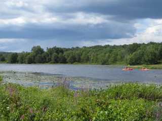
According to my instructions, the goal for participants is “to take photos of the UMass campus [buildings, locations, landscaping, etc.] that demonstrate the campus is attractive,” across as much of the campus as possible. We were given Nokia N95 cell phones with a specially-designed Photobase software application, loaned to us for a three-day period, and asked to take photos at our leisure. These photos were automatically uploaded to the experiment webserver within minutes after we took them. We were then expected to log in to a secure website and rate all photos (1 to 5) taken during the designated time period. Each cell phone had a built-in GPS unit, so all the photos on the website were geocoded.
I hate taking photos and have always believed that the UMass campus is uniformly ugly, so you’d think I was exactly the wrong person to participate in this study. On the other hand, I’m conscientious with respect to the commitments I make, so I think I acquitted myself well, even if I couldn’t spend a lot of time on this project (I work full-time and also have an hour-long commute to UMass). I have no idea how many photos I took or how they were rated, but I did try very hard to find attractive features on campus and photograph them. On Tuesday July 29th I travelled around campus after work; on Wednesday July 30th I spent my entire lunch hour taking photos and also took photos until it got dark; and on Thursday July 31st I was only able to photograph a few sites early in the morning. Each night I rated photos on the website, including my own.
When subjects logged in to the website, we saw a Google map of the UMass campus, with little balloon icons showing where photos had been taken. The website also included a “leader board” which listed us by code name in order of points accumulated through ratings of our photos. I knew about this feature but didn’t pay any attention to it because it was way off to the right on the page and wasn’t even visible unless I used my scroll bar. Anyway, I was more concerned with evaluating the photos fairly. These were displayed as thumbnails over on the left; when you clicked on a thumbnail, the cursor moved to the location on the campus map where it was taken. You could also rotate the photo or click on it to view it in the larger format. Since I’ve worked at UMass for almost ten years, I consider myself fairly familiar with the campus, if only theoretically. So I tended not to pay attention to the map as I rated the photos.
I tried very hard to ignore the quality of the photos; instead I looked at each photo and asked myself, Does this demonstrate that the campus is attractive? At times, it was difficult making a decision NOT to rate a beautiful and striking photo highly. For example, some of the photos of flowers I liked a lot, but there was nothing in the photos to indicate they were taken on a college campus, so I gave them 1s or 2s. Likewise, some of the photos, such as ones of the running track, were unusual and captivating, but I wouldn’t call them beautiful in the conventional sense, so I did not rate these highly either.
There is a truism that states “Beauty is in the eye of the beholder” which came to mind as I was working on this project. In my case, I don’t find brick and concrete buildings aesthetically appealing (I prefer stone and wood as building materials). Inasmuch as the UMass campus has a lot of brick and concrete monstrosities, I can’t honestly say that I find it attractive on the whole. There is also a whole lot of construction going on as we speak! This was probably not an optimal situation for participants in this experiment.
I do have my personal lists. Here are my votes for the ugliest buildings on campus:
- Tower Library
- Lederle Graduate Research Center
- Fine Arts Center
- Whitmore Administration Building
- Campus Center
And the most beautiful?
- Old Chapel
- North Dorms
- Marcus Hall
- University Club
- Stockbridge Hall
I’m quite sure the photos we took are currently the property of the Computer Science Department, so I didn’t copy any of the images while I was on the website (maybe we couldn’t). And even though we could selectively view the best and worst images, I didn’t do this, so I couldn’t even tell you how my ratings compared to those of the other participants. Maybe one of these days, I’ll take photos with my own newly-purchased digital camera and post my picks for loveliest locations on campus as an update to this blog post.
The study co-ordinator has research interests in machine learning and neural networks, and I don’t really understand how this geo-tagging, photo-rating project relates to this interest, but hey, what do I know from neurons. This particular study has to do with “collaborative sensing and peer production systems,” whatever that means (Wikipedia, Flickr, and Yahoo Answers are termed peer production systems). For my part, I had a blast running around campus, venturing into new areas, trying not to have my car ticketed, and simply looking around with a different perspective.
[Update on Aug 19: There is now a website to inform the public about the Photobase project! The “About” tab describes the project, and the “Gallery” tab includes a changing display of the photos, perhaps even some of mine.]